PAGASA Alert: LPA Outside PAR Could Become Tropical Depression Within 24 Hours
Heads up, Pilipinas — PAGASA is tracking a low pressure area (LPA) outside the Philippine Area of Responsibility that could develop into a Tropical Depression within the next 24 hours. While the chances are still low for now, it's something to keep an eye on.
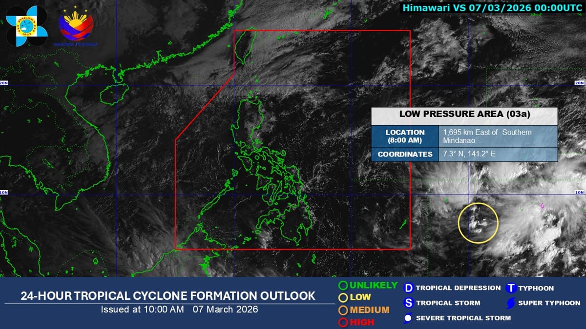
As of 8:00 AM on Saturday, March 7, 2026, the weather bureau confirmed it's monitoring the system and advised the public to stay updated on official forecasts. The LPA is still outside PAR, but weather conditions across the archipelago are already being shaped by the easterlies and the Northeast Monsoon (Amihan).
PAGASA says most of the country can expect cloudy skies and scattered rains today. Batanes, the Babuyan Islands, Apayao, Mainland Cagayan, and the Ilocos Region will see cloudy skies with light rains, while the rest of the Cordillera and Cagayan Valley will have partly cloudy to cloudy conditions with isolated light rains courtesy of the Amihan.
For the rest of the country — including Metro Manila, Visayas, and Mindanao — expect partly cloudy to cloudy skies with isolated rain showers or thunderstorms from the easterlies. Northern Luzon will experience moderate to strong winds with moderate to rough seas, while the rest of the archipelago will have lighter winds and calmer waters.
No need to panic just yet, but it's that time of year when weather systems can develop quickly. Stay tuned to PAGASA updates, and maybe keep that payong handy just in case.
Source: GMA News