Heads Up, Visayas and Mindanao: LPA Outside PAR Just Became a Tropical Depression
Brace yourselves, Visayas and Mindanao — PAGASA just confirmed that the low-pressure area (LPA) being monitored outside the Philippine Area of Responsibility has officially developed into a tropical depression as of Tuesday morning, March 10.
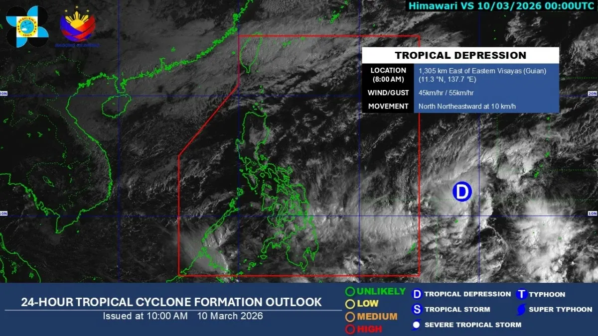
As of 8 a.m., the tropical depression was spotted approximately 1,305 kilometers east of Eastern Visayas, packing maximum sustained winds of 45 kph near the center with gusts reaching up to 55 kph. It was moving north-northeastward at 10 kph, and while PAGASA says it has a low chance of actually entering PAR, its trough is already making its presence felt.
The extension of the storm system is expected to bring cloudy skies with scattered moderate to heavy rains and thunderstorms across Masbate, the Visayas, and Mindanao. Residents in these areas should prepare for possible flooding and landslides, especially in low-lying and mountainous regions.
Meanwhile, the northeast monsoon or "amihan" continues to dominate Luzon, bringing cloudy skies and light rains to Cagayan Valley, the Cordillera Administrative Region, Aurora, Quezon, and the Bicol Region. Metro Manila and the rest of Luzon can expect partly cloudy to cloudy skies with isolated light rains.
PAGASA weather specialist Veronica Torres confirmed that no other LPA or tropical cyclone is currently being monitored inside or near the PAR aside from this system. Stay dry and stay safe out there, mga kababayan.
Source: Manila Bulletin