Bagyong Caloy Watch: Tropical Storm Hagupit May Enter PAR This Weekend
PAGASA says Tropical Storm Hagupit may enter the Philippine Area of Responsibility this weekend and will be named Caloy once inside PAR.
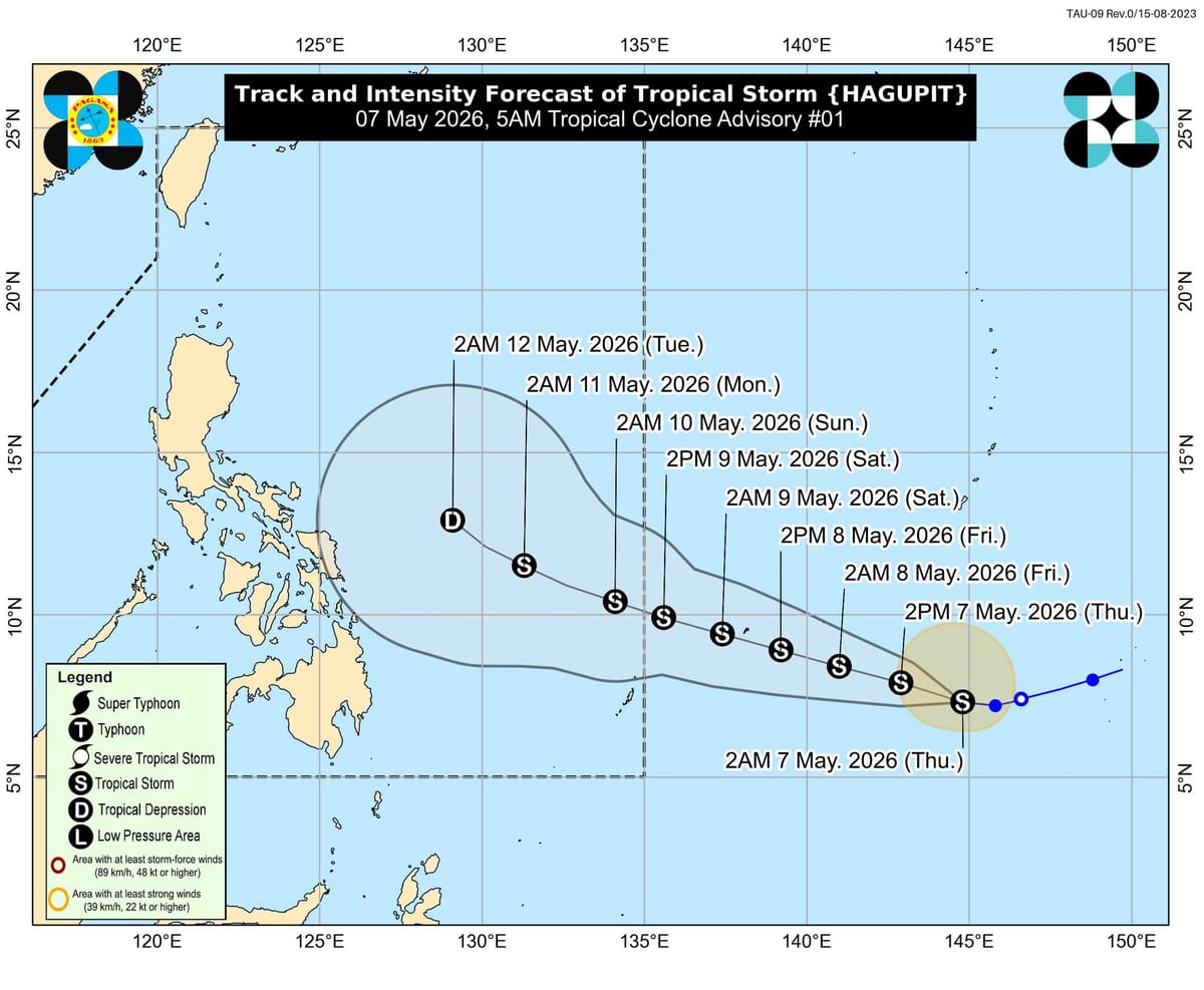
PAGASA is now monitoring Tropical Storm Hagupit, which may enter the Philippine Area of Responsibility between Saturday evening, May 9, and Sunday morning, May 10. Once it enters PAR, the storm will be given the local name Caloy.
In its 5 a.m. tropical cyclone advisory on Thursday, the weather bureau located Hagupit about 1,995 kilometers east of Northeastern Mindanao, still outside the Philippine monitoring area. The storm was moving westward at 20 kilometers per hour.
Hagupit was packing maximum sustained winds of 65 kph near the center and gusts of up to 80 kph, according to PAGASA. Strong to gale-force winds extended up to 270 kilometers from the storm’s center, making it a system worth watching closely.
The storm is expected to continue moving westward in the short term before turning west-northwestward for the rest of the forecast period. PAGASA said Hagupit may still intensify in the next 48 hours and could peak as a high-end tropical storm.
For now, PAGASA said Hagupit is less likely to directly affect weather or sea conditions in the next three days, but the public and local disaster risk reduction offices were advised to keep monitoring updates. Source: GMA News Online