Bagyong Caloy Update: Tropical Storm Holds Strength East of Mindanao
Tropical Storm Caloy stayed east of Mindanao while easterlies bring isolated rains across the Philippines, PAGASA said.
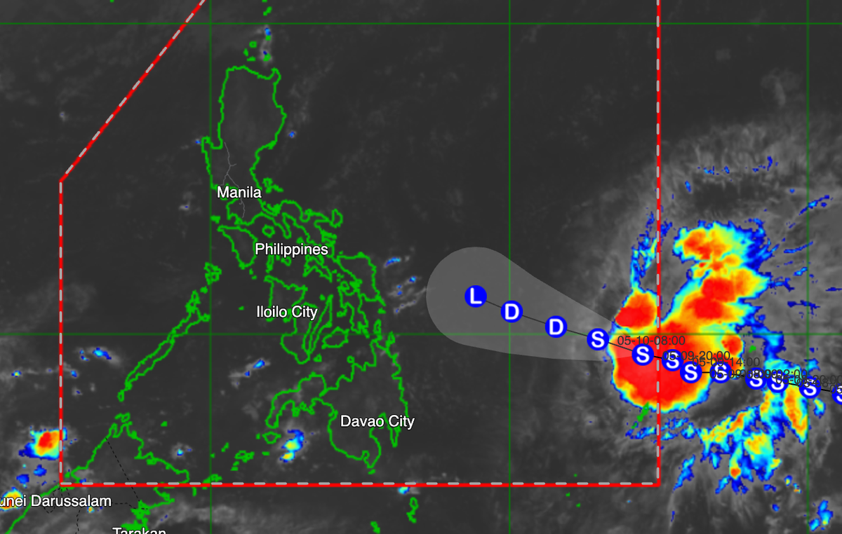
Bagyong Caloy remained a tropical storm early Sunday as it moved west-northwestward east of northeastern Mindanao, according to PAGASA’s 4 a.m. weather bulletin cited by GMA News.
PAGASA estimated Caloy’s center at about 925 kilometers east of northeastern Mindanao as of 3 a.m. The storm had maximum sustained winds of 65 kph near the center and gusts of up to 80 kph, while moving west-northwestward at 15 kph.
For now, easterlies are still affecting most parts of the country. Metro Manila and the rest of the Philippines may see partly to mostly cloudy skies, with isolated rain showers or thunderstorms.
PAGASA warned that severe thunderstorms may still trigger flash floods or landslides in affected areas. Extreme northern Luzon may also experience moderate to strong winds and moderate to rough coastal waters, with waves from 1.2 to 2.8 meters.
In Quezon City, PAGASA’s Science Garden station recorded a high of 35.6°C on Saturday afternoon and a low of 26.4°C in the morning. Sunrise on Sunday is at 5:30 a.m., while sunset is expected at 6:15 p.m.
Feature image: Tropical Storm Caloy was tracked east of northeastern Mindanao in PAGASA’s early Sunday bulletin. Image: GMA News / PAGASA bulletin screenshot
Source: GMA News Online